


Lord of Maps
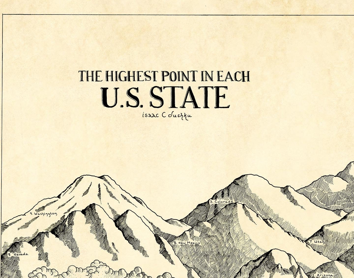
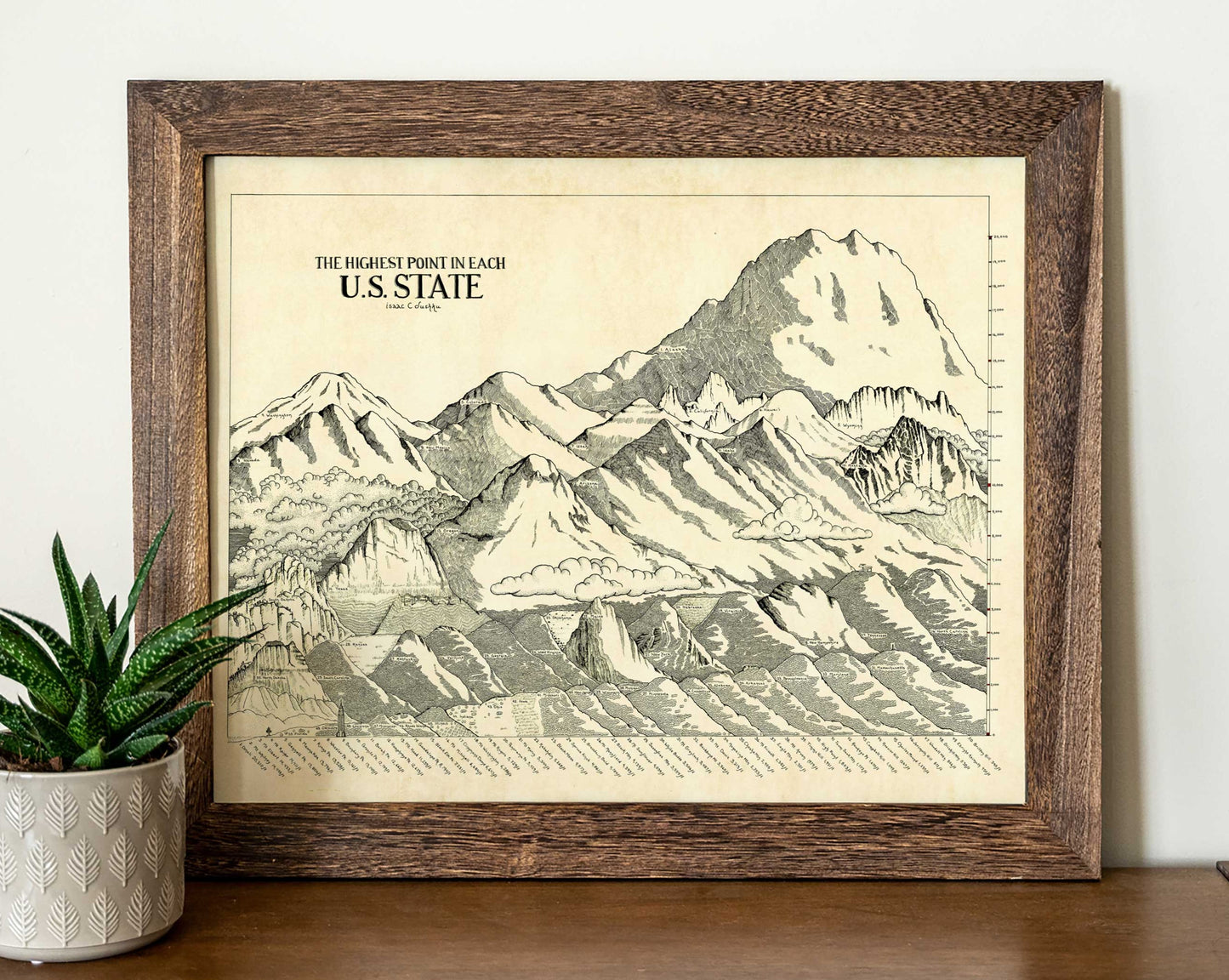
Highest Mountains Map
Highest Mountains Map
Couldn't load pickup availability
Now in Book form!


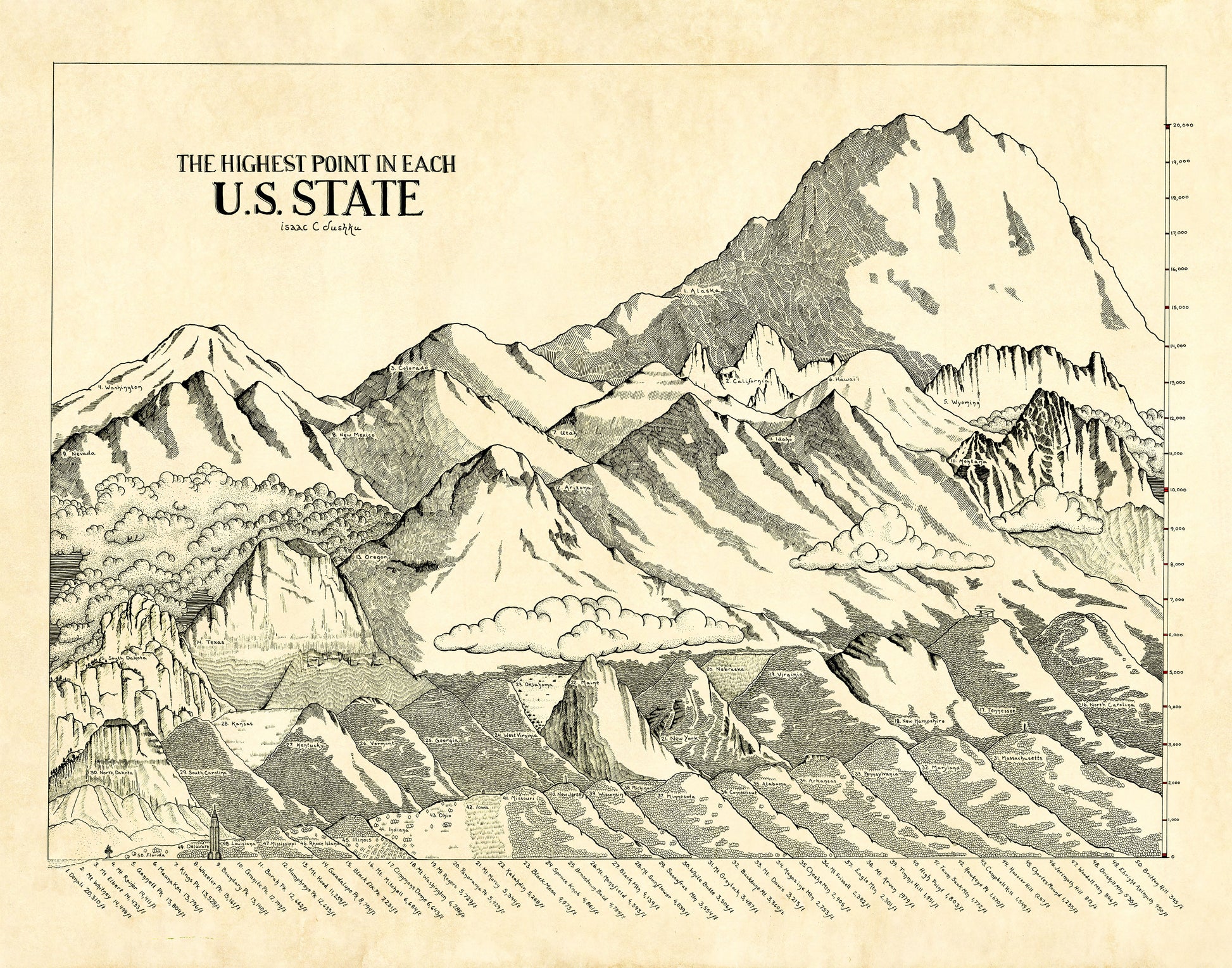
Are you the kind of crazy person who climbs large heaps of rocks for fun? Do you frequently miss exits because you are staring at the mountains? Then this map is for you!
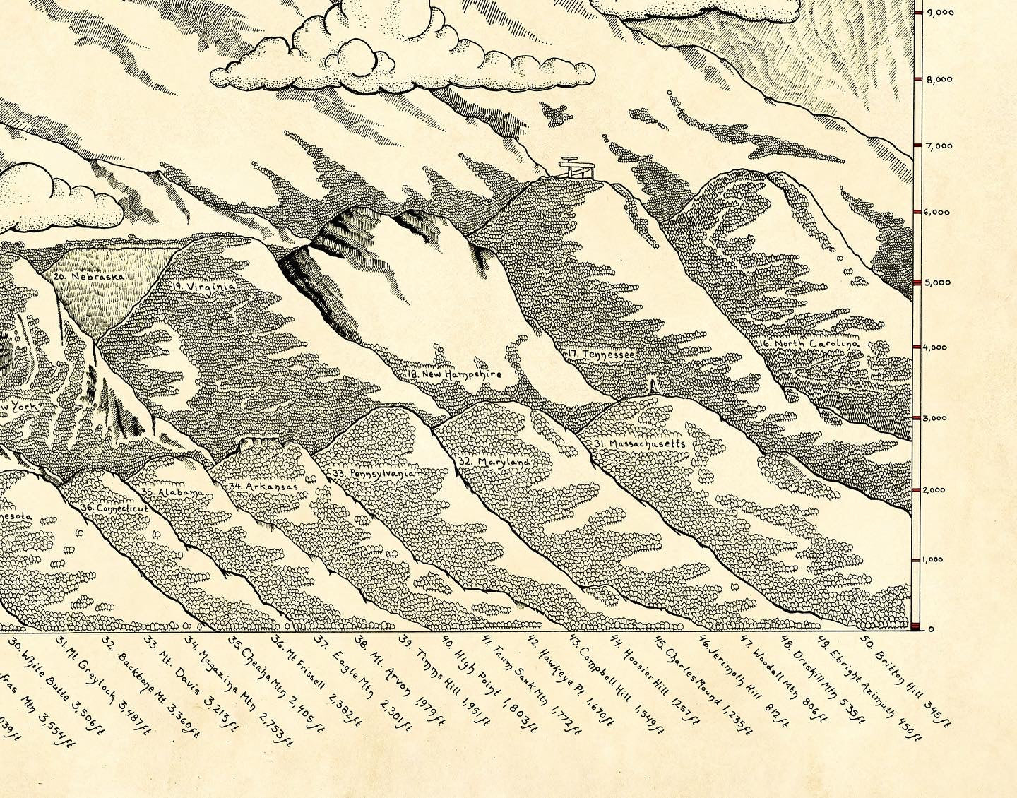
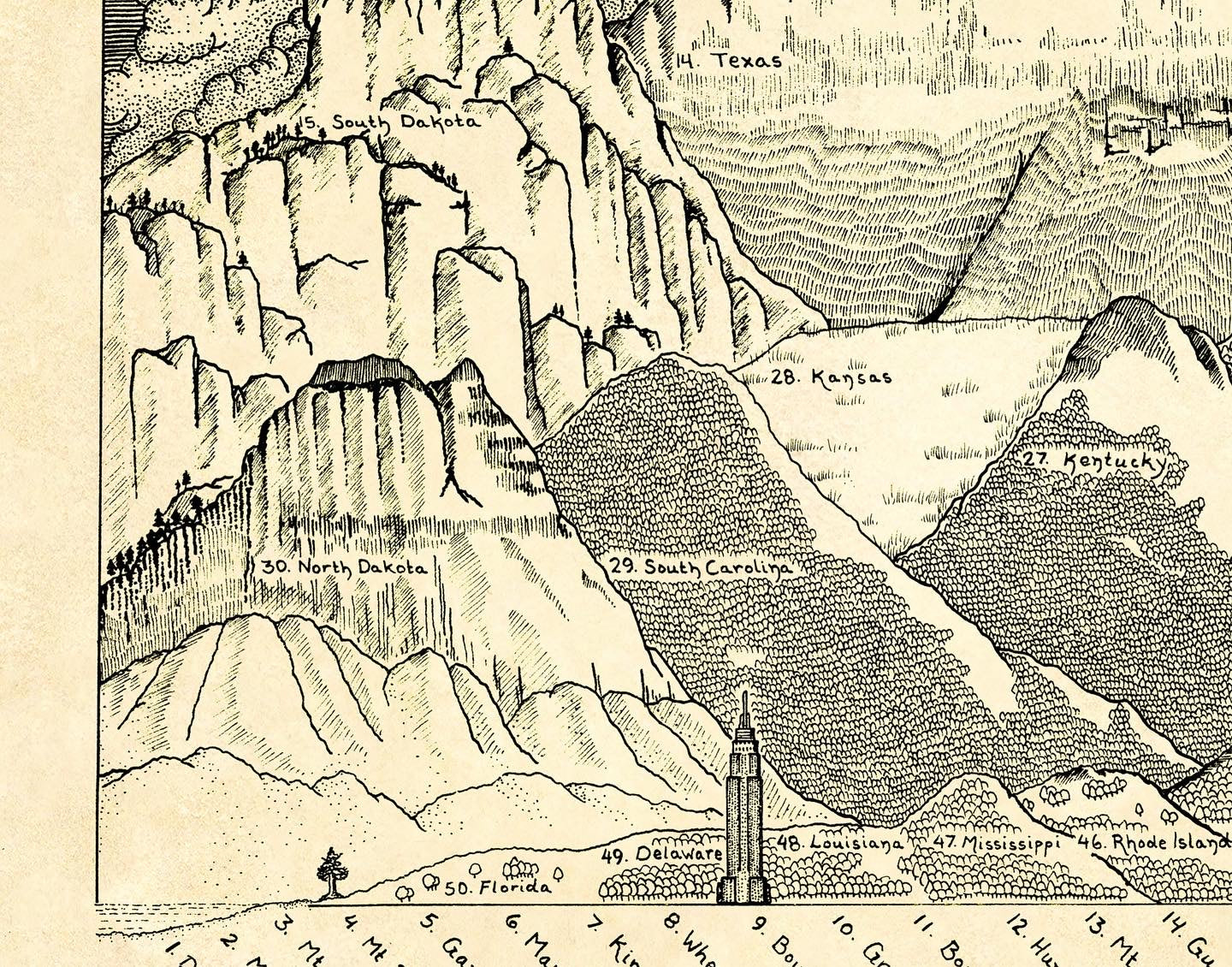
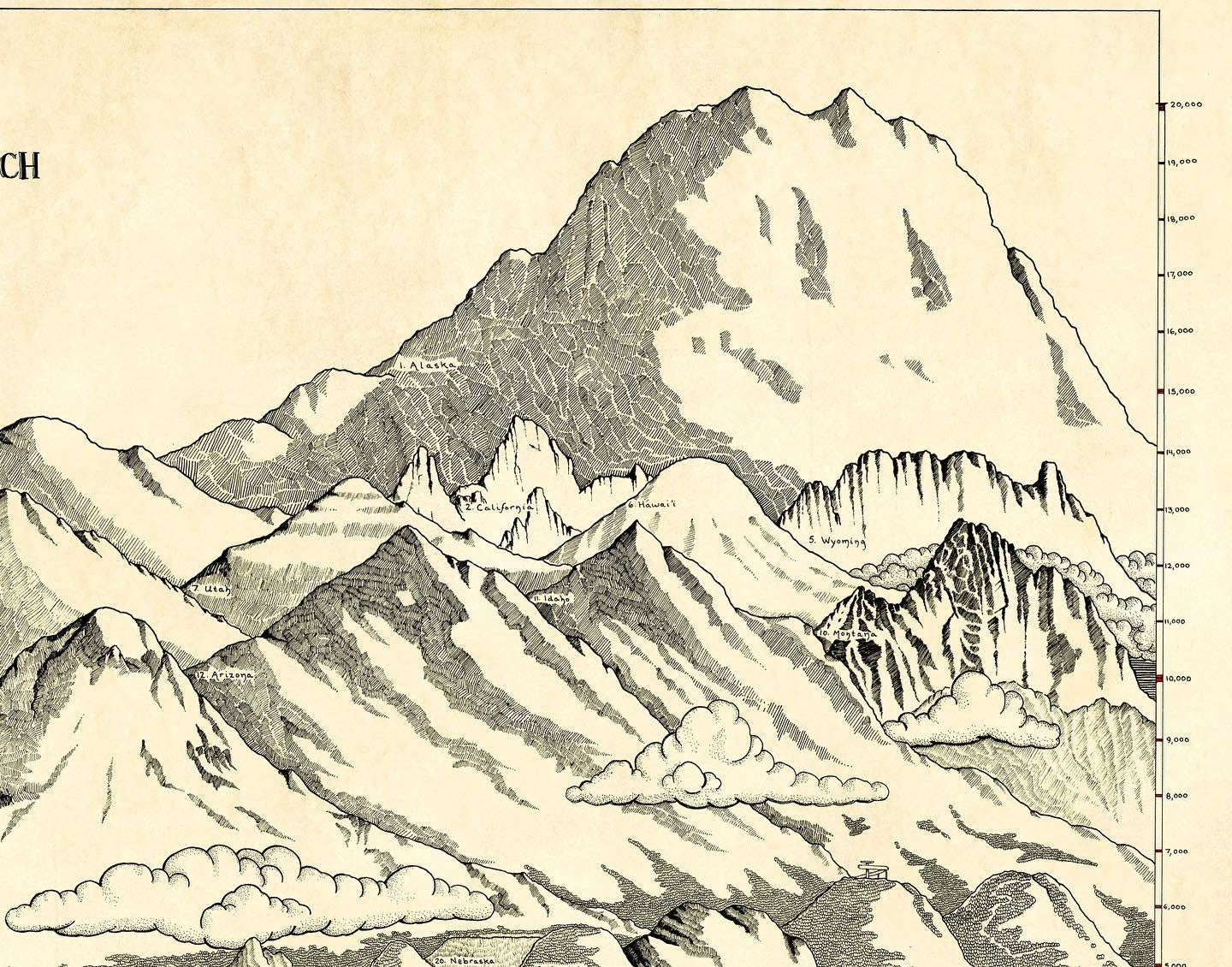
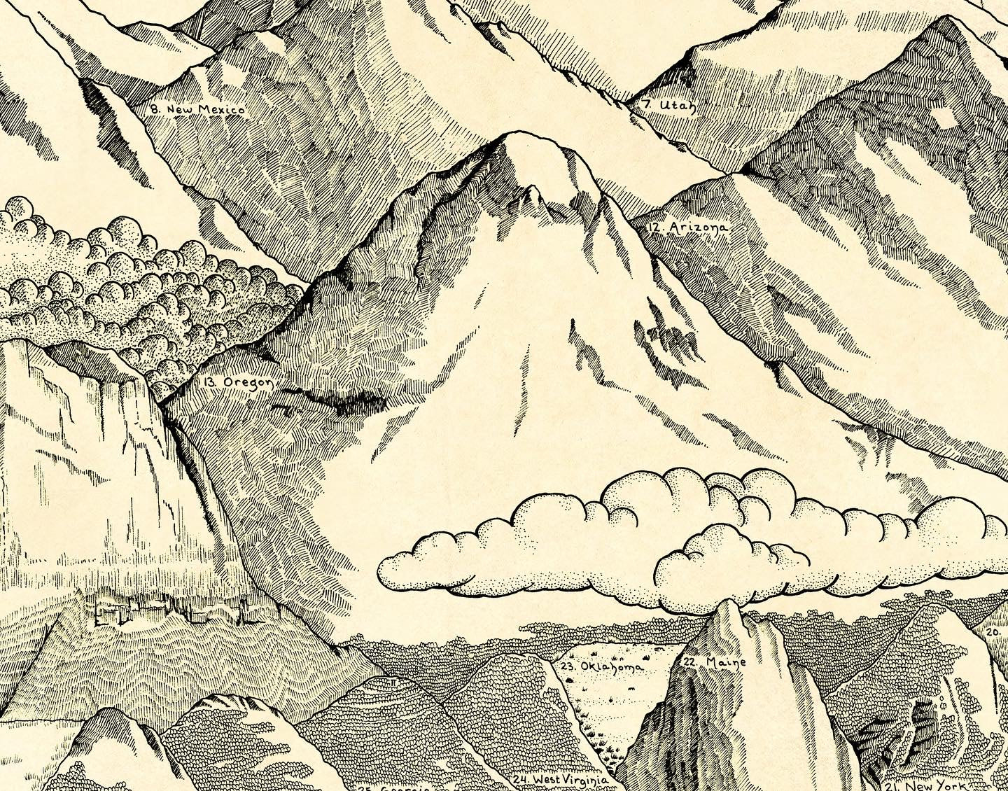
I couldn't find anywhere a diagram with the high points of each US state stacked right next to each other. So I made one. I've always wanted to compare the mighty Rockies with the less mighty Appalachians. Now, thanks to many long hours, I can.
These are the highest "mountains" in each state. Some are little more than hills, some are vast stretches of flat land. Others are towering goliaths.
The heights of each point are to scale. Some artistic liberties have been taken and some stats might spark old debates.
Artist and Chief Map Officer: Isaac Dushku
Dimensions:
Inches
The 16x20 is about 9.85 x 10^-4 of Mt Denali's height
The 22x28 is about 0.0013 of Mt Denali's height.